

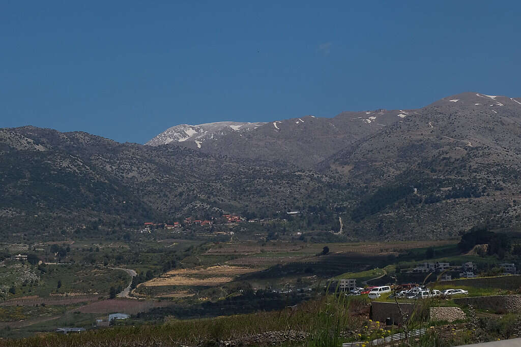
A significant winter weather system is approaching Israel, with meteorologists closely monitoring conditions that could bring snow to the country's northern mountains and possibly even Jerusalem by the weekend.
The incoming cold front promises to drop temperatures significantly, creating conditions conducive to snowfall across various mountainous regions, while raising concerns about potential flash floods in the Judean Desert.
A perfect snowy weekend? Heading into Friday, temperatures will drop significantly – raising the possibility of snow in parts of the country, particularly in the higher northern mountains. On Saturday, temperatures will continue to plunge, with snow possible across most of the country's mountainous regions – including the southern mountains.
However, the remaining question is whether this cold front will be accompanied by moisture-laden clouds – which could turn to snow in areas where temperature conditions are suitable. Currently, while clouds are moving in, they are relatively weak – meaning they will primarily bring light rain or light snow. So for now, it appears that even if snow falls, it won't accumulate. But don't be disappointed – it's worth waiting and following the weather models, which are currently split on the question of precipitation amounts, to better predict this cold and rainy front.
Meanwhile, conditions for varying levels of rain exist for Monday in northern Israel and the central mountains.
Monday will be clear to partly cloudy. Local rains are expected in northern Israel and the central mountains during afternoon hours, accompanied by isolated thunderstorms. Temperatures will be seasonal. At peak daytime, the Golan Heights will see 16 degrees (61 Fahrenheit), northern mountains 12-13 degrees (54-55 Fahrenheit), central mountains 14-15 degrees (57-59 Fahrenheit), southern mountains 18 degrees (64 Fahrenheit), coastal areas 19 degrees (66 Fahrenheit), and lowlands 19-20 degrees (66-68 Fahrenheit). The Mediterranean Sea will be calm to wavy with waves 40-70 centimeters (16-28 inches) high.
The Sea of Galilee will be calm with waves 20-40 centimeters (8-16 inches) high, water temperature 18 degrees (64 Fahrenheit). The Red Sea will be calm with waves 20-40 centimeters (8-16 inches) high, water temperature 22 degrees (72 Fahrenheit). In the morning hours, rain clouds will enter northern Israel from the Hadera area, these clouds will move eastward and reach the Golan Heights by afternoon, followed by clouds entering the mountainous areas including the Negev mountains. These clouds will bring scattered local rainfall. Rain clouds will move eastward, so caution is advised regarding flash floods in the Judean Desert area.
Tuesday will be clear to partly cloudy with a slight rise in temperatures. Regarding peak daytime temperatures, the Golan Heights will see 17 degrees (63 Fahrenheit), northern mountains 14-16 degrees (57-61 Fahrenheit), central mountains 16-17 degrees (61-63 Fahrenheit), southern mountains 19 degrees (66 Fahrenheit), coastal areas 20-22 degrees (68-72 Fahrenheit), and lowlands 22-23 degrees (72-73 Fahrenheit).
Wednesday will be partly to mostly cloudy, primarily with medium and high-level clouds. A slight temperature drop will occur. From afternoon hours, drizzle to light rain is possible, mainly along the coastal plain. Regarding peak daytime temperatures, the Golan Heights will see 16 degrees (61 Fahrenheit), northern mountains 13-14 degrees (55-57 Fahrenheit), central mountains 14-15 degrees (57-59 Fahrenheit), southern mountains 18 degrees (64 Fahrenheit), coastal areas 18-19 degrees (64-66 Fahrenheit), and lowlands 18-19 degrees (64-66 Fahrenheit). Regarding rain clouds, these will enter the coast but will deepen toward evening into mountainous areas including the Negev mountains.
Thursday will see rain clouds entering various parts of the country, with initial rain cloud drama followed by significant rain clouds entering northern Israel in the afternoon hours. Friday will bring light rains mainly in central Israel, reaching the eastern part of the country. Toward evening, light clouds will cover Israel up to the central Negev. Later during Saturday, rains will fall on the coast and Negev, with rains reaching the Eilat area.
Friday's temperatures will plummet with daytime peaks in coastal areas at 13-14 degrees (55-57 Fahrenheit), lowlands 13-14 degrees (55-57 Fahrenheit), central mountains 6-8 degrees (43-46 Fahrenheit), northern mountains 5-6 degrees (41-43 Fahrenheit), Golan 10-11 degrees (50-52 Fahrenheit), and southern mountains 8-11 degrees (46-52 Fahrenheit). Nighttime temperatures will be 9-11 degrees (48-52 Fahrenheit) on the coast, lowlands 8-9 degrees (46-48 Fahrenheit), central mountains 3-4 degrees (37-39 Fahrenheit) – temperatures that allow for snow, northern mountains 2 degrees (36 Fahrenheit) – also snow-enabling temperatures, Golan Heights 5 degrees (41 Fahrenheit), and southern mountains 6-7 degrees (43-45 Fahrenheit).
The temperature drop will continue Saturday with snow conditions possible in many areas across the country. Golan Heights will see nighttime temperatures of 3 degrees (37 Fahrenheit), northern mountains 1 degree (34 Fahrenheit), central mountains 1-3 degrees (34-37 Fahrenheit), southern mountains 4-5 degrees (39-41 Fahrenheit) meaning small chances of snow exist, coastal areas 9-11 degrees (48-52 Fahrenheit), and lowlands 8-9 degrees (46-48 Fahrenheit). The northern plateau will experience frost at night.


